

Generally, remote sensing is the technology that is intended to observe the earth’s surface with the help of satellites, airplanes, and drones by deploying a camera in them. The sensors in the sensing tools capture the data related to the target then it will be processed as an image for the analytical purpose. In other words, remote sensing is the science technology that is used to gather data of the surface which cannot be manually visualized.
“This article contains the data about the possible Project Topics on GIS and Remote Sensing in wide coverage”
Furthermore, we will see about, how to collect the remote sensing data in real-time. We would like to share the victories about our guidance and project ideas on emerging technology. As we have the benchmark remarks on our guidance in researches and projects for the scholars and the college students we render the best ideologies in the project topics in the current technical requirements.
How to collect the Remote Sensing Data?
- Seaborne – Devices SONAR
- Satellite Sensors – INSAT and Landsat satellites
- Airborne Devices – Air crafts and Drones
- Handheld Devices- Spectrometer, camera, and Transmissometer
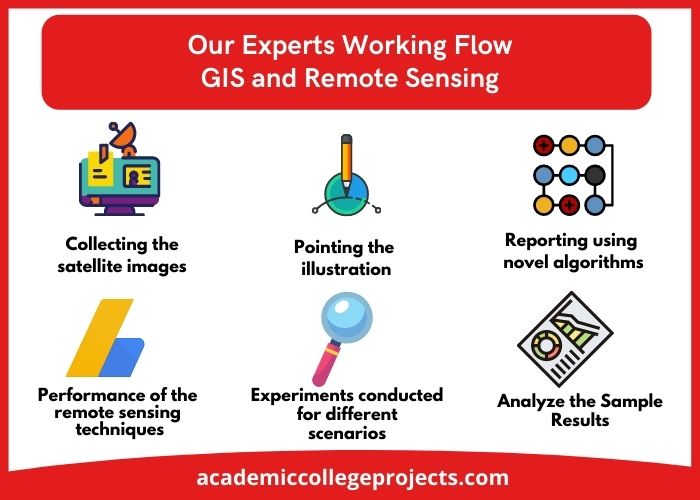
These are some of the platforms for acquiring remotely sensed data. We are liable to make the note of our expert’s working flow. They are explained below for your understanding.
Our Experts Working Flow
- Collecting the satellite images and understanding the same
- Pointing the illustration for the ground analysis sample
- Examining and reporting using novel algorithms
- Compare the performance of the remote sensing techniques by more scenarios
- Experiments conducted for different scenarios and also parameters
This is how our experts do the working on remote sensing in general. At this time, research ideas will be resulted in tremendous ways by deploying the right working module. In addition to we are the company with clear ideas and working flows for effective results. The next step is all about an overview of the Project Topics on GIS and Remote Sensing in detail.
Overview of GIS and Remote Sensing
Remote Sensing
- Remote sensing is a tool that is collecting data about the earth’s surface with the help of sensors in satellites or aircraft.
- There are two types of sensors is existing they are active and passive sensors
- Active sensors represent the internal inducements following the earth surface produce energies (laser-beam remote sensing system)
- Passive sensors represent the external inducements that collect the energy produced by the earth surface
- For best instance remote sensing in agriculture will lead to soil management and insects issues and so on
GIS (Geographical Information System)
- The GIS is an effective tool that is integrated with remote sensing for the visualization of the geographic status of the earth
- This is the tool designed for the support of remote sensing in the fields like recording, managing, examining, and visualizing the spatial information
So far we had seen how to collect the remotely sensed images and the overview of the Geographical Information System and the Remote Sensing in detail. Now is the time to know about the working flow of the GIS and remote sensing.
Workflow for GIS and Remote Sensing
- Examining the various (multi) scenes by spectral values
- Acquire data in a geographical location with the use of the following attributes
- Time series
- Location
- Multi-image
- Climatic changes
- Same sensors for the spatial and spectral resolution
- This is done based on the multiple scenes that arise in the study
- Collects remote sensing data and gathered it to generate the datasets.
- Next, involves radiometric, atmospheric, and ortho corrections
- The surface is subject to the comparison of the various location, research phases that indulge in more than one scenery capture
- Finally, classify the object or scene for further processing
As of now, we had seen the categorical classifications of the GIS and Remote Sensing in detail. We strongly suggest you have an interaction with our experts for the best outcomes of your research and projects in networking and emerging technologies. Today, we are very happy to transfer our knowledge to you in the sense of research and project guidance. We are always there for you to help in this aspect. Without wasting time let us discuss the current trends on GIS and Remote Sensing.
Current Trends in GIS and Remote Sensing
- Ocean Applications
- This represents the flow of the ocean, temperature, icebergs, and the wavelengths by the observation of the deep seas
- This will help us to maintain the oceans in an effective manner
- Administration of the natural resources
- This observes the land uses, wildlife environments and point the swamplands
- This will lead us to take safety measures with predetermined methods to protect the environment from pollution
- Coastal applications
- This will help us to take safety measures in the seashore changes by gathering data on residue transportation through the seas and plotting the sea characteristics
- Danger Assessment
- This is the assessment that identifies the erosions, storms, volcanic activity, and flooding
- The gathered data will be used to take preventive measures before and after exploitations of the hazard events
“Our knowledge hulks are always delighted to assist you in the fields of emerging technology facts and ideologies”
In the emerging technical world, one must know about the programming involved in the Geographic Information System. This is the growing technology; it will enrich one’s career growth abundantly. Every individual can understand this GIS because it doesn’t require a wide knowledge of programming project topics on GIS and remote sensing. We had written this article to the GIS subject matter experts who want to explore more in this field. In this regard, we will see about the programming languages used in remote sensing projects.
Programming languages for Remote Sensing Projects
- C#
- Remote Sensing with Python
- Javascript
- .NET
- C++
In the following, an explanation of programming languages is described.
JavaScript
- JavaScript is widely used in every web customization because it is the core language used in it
- Location mapping apps make use of the javascript for the effective results
SQL
- The acronym stands for Structured Query Language
- This facilitates to make an influence in the geospatial database
Python
- We can make an influence in the python libraries as they are open-source data that will sink accurately
- It is habitually utilized in the Geographical Information System as its programming language
- C++ and the .NET programming languages are capable of the window-based operating systems instead of Linux and Unix operating systems
R
- This is a free language which is intended for the examination of the geospatial, visualizations, and arithmetical based computation
Java
- This is the well-developed programming language used in the application creation
- This is the substitute for the above-mentioned languages
This is especially meant for the map servers for instance it is the pillar language used in the GEO map server far, we have discussed the collection of the Remote sensing data, an overview of GIS and remote sensing, workflow for GIS and remote sensing, current trends on GIS and remote sensing, and programming languages for remote sensing projects in detail.
We hope that these ideas and outlines will be very short and crisp for your better perspectives. In addition to every technology needs research for advancement hence the researchers in the industry continuously researching the emerging technology. Usually, it needs an expert’s guidance as we are having the experts who are filtered out. For any queries feel free to approach us for innovative project topics on GIS and Remote Sensing.
“We are a delight to serve you in the fields of research projects that are emerging in recent technology”
Now we will discuss the tools that are available for the GIS and remote sensing projects wide. Without wasting the time we will move to the next phase. They are mentioned by our expert’s experiments in real-time.
Tools for GIS and Remote Sensing projects
- RTool (open-source tool)
- MATLAB (commercial tool)
- Python (open-source tool)
These can be used following their features. Matlab is a commercial remote sensing tool that is specially designed for effective graphical visualizations. R is the open-source and free remote sensing tool used for investigation purposes and python is widely utilized in the GIS allied errands. Every technology owes some systematic processes. The process will effectively enrich the technology. In this regard, let us see the Major process involved in the GIS and remote sensing in detail.
Major 3 Processes in GIS and Remote Sensing
Image Pre-processing
- Radiometric, atmospheric and geometric corrections will showcase the effective perspective
- This also leads the interaction with each field by enrichment of the intensity of the images, and effects
- Comparison of the fields leads to elimination of the misrepresentations
Image Enhancement
- Enriching the interpretability of the pictures produced by the sensors
- Spatial element filtering and enriching the boundaries
- Influence of the multi-images by rationing the bands, aspects, canonical aspects, and vegetation features
Image Classification
- This helps to investigate the earth conditions in the form of human-understandable mode
- Temporal pattern recognition helps to identify the changes aroused in the pixel over the era for the modulation of the features
- Spectral pattern recognition filters the radiance in each pixel for the better understanding
These are the classification of the images that are captured by the sensors. We hope that you will understand the aspects and concepts behind them. Following the ease of your understanding, our experts made this article in different real-time perspectives. Without wasting the time we will move to the theme that how to analyze the GIS and remote sensing data.
Investigation of the technology eminently plays a vital role in the effective execution of the technology!!
How to Analysis the GIS and Remote Sensing Data?
- Discovery of the resources (what are all the resources available and where?)
- Immediacy Analysis(discovering the relevant area that is apt for the choice-making)
- Evaluating the geographical areas, detachments, and route extensions
- Examining the location(for fixing the industry in the right place, warehouse implantation)
- Investigation of the network(location apps for ensuring the earlier arrival)
- Spatio-Temporal Investigation(analysing the changes made to the land in the past 20 years)
- Topography examination(analysing the most vulnerable area which is subject to the natural ruins or disasters)
This is how the developers of the GIS and remote sensing subject matter experts will analyze the research topics on GIS and Remote Sensing in general as we do. Our experts of the concern have mentioned to you the trendy project ideas in GIS and remote sensing technology.

Top 10+ Research Project Topics on GIS and Remote Sensing
- Amalgamated urban studies based on Ontologies
- Consideration of the urban transportations
- Innovative cities and semantic technologies
- Route and operation analysis
- Integration of the multimodal in urban areas
- Location discovery services in urban areas
- Urban development data by the sensors
- Reclamation of the geographic data
- Query handling and optimizing of spatial
- Spatial reasoning and designing
- Structural design of the geographical and middleware
- Spatial and temporal handling of geodata
So far we gave you the overall view of the remote sensing technology and the Geographical Information System in wide coverage. Without a doubt, we hope that this article will ensure the best perspectives in real-time. Reach us if you are interested in implementing research project topics on GIS and Remote Sensing. Thanks for reading.
Happy researching and learning with our effective research and project assistance. We are there for you to transfer our knowledge!!